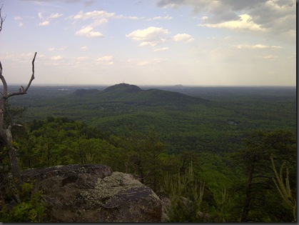
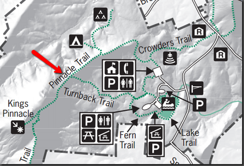
Had the opportunity to join some existing friends and make some new ones on a short but challenging hike up Pinnacle Trail at Crowders Mountain state park. Based on the trail map, Pinnacle has a difficulty rating of strenuous. I think to get to that it is a combination of how fast you walk and the kind of shape you are in. If you stroll up this trail I would say it is fairly easy. If you walk with real purpose and try to make the fastest time possible you will breath hard. If you are not use to this you will pass out! I was somewhere between breathing hard and passing out as we reached the top. It is not a long trail, only 3.4 miles round trip from ant to the park office. You start up a small rise and then move along a ridge for the first mile. The last half mile is more steep and the last 2 tenths are pretty steep and at the very end you are basically rock climbing. The views were great, as we reached the top of the mountain it was obvious that we were lucky from a weather standpoint. As I looked west it was raining toward Blacksburg and then I looked east and it seemed to be raining there as well. The wind picked up and there was a nice cool breeze that gusted at times. Here is a photo of the view from the top. Sorry the only camera I had was my blackberry so its not the best shot in the world.
click the album below to see the rest of the photos taken on this trip.
 |
| Crowders Mtn. Pinnacle Trail |
Here is a small part of the trail map for reference. I will also paste a link to the full map under “Trail Links” to the right.
Helpdesk


